The Kokoda Track: the sacred trail

Even before I had packed a single suitcase, I was already scouring the internet to learn more about Papua New Guinea when I quickly came across this legendary path — this “sacred trail” for Australians on Papuan soil.
It was along this very route, through the jungles and mountains of the Owen Stanley Range in Papua New Guinea, that one of the pivotal battles of the Pacific War took place, marking a turning point in favor of the Allied forces.
First descent, immediately after the arch marking the start of the trail
But more than that, it was along this track that young, poorly trained Australian soldiers showed remarkable courage, enduring the hardships of a hostile natural environment — torrential rain, tropical diseases like malaria, the sweltering heat of the day, and freezing nights in the mountains — all in the name of defending the free world.
To recall the historical context: the year is 1942. Since 1931, the Empire of Japan had seized control of vast territories across the Pacific. Manchuria, the Philippines, the Dutch East Indies, Hong Kong, Malaysia, Singapore, Burma... one after the other, they all fell into Japanese hands.
Now, the Japanese threat loomed directly over the Western world — and specifically over Australia, then a dominion of His Majesty King George VI (the grandfather of the current British monarch, King Charles III).

Japanese conquests in the South Pacific from 1941 to 1943
If they managed to seize control of the city of Port Moresby, they would then be in a clear position to directly threaten Australia and cut off the sea route connecting the Pacific and Indian Oceans — effectively preventing Allied reinforcements from arriving.
There was no other choice for the Australian boys than to make direct contact and stop the advance of the Japanese forces, already firmly established in the north of the island of New Guinea.
The squad — a few hundred men in fatigues and army boots, burdened with heavy gear completely unsuited for mountain trekking — marched with composure into the rainforest, carving a path toward the enemy. For nearly 600 of them, it was above all a path to death — but a heroic death, one in the field of honour.
This battle was, in fact, the first in history where Australia had to fight for its own national security.

Australian soldiers crossing the Brown’s River on the Kokoda Track - National Museum of Australia
It is now 2022, eighty years later, and the Kokoda Track — or Kokoda Trail — has become an open-air museum, a site of remembrance, and a hiking trail stretching over 60 miles, or 96 kilometers. It leads trekkers up to an altitude of just over 2,000 meters.
It takes around seven days (for a physically fit walker!) to complete the full trek and reach the final destination: the village of Kokoda. And by continuing on toward the town with the lovely name of Popondetta, one finally reaches the other coast, on the northern side of the island of New Guinea.
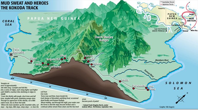
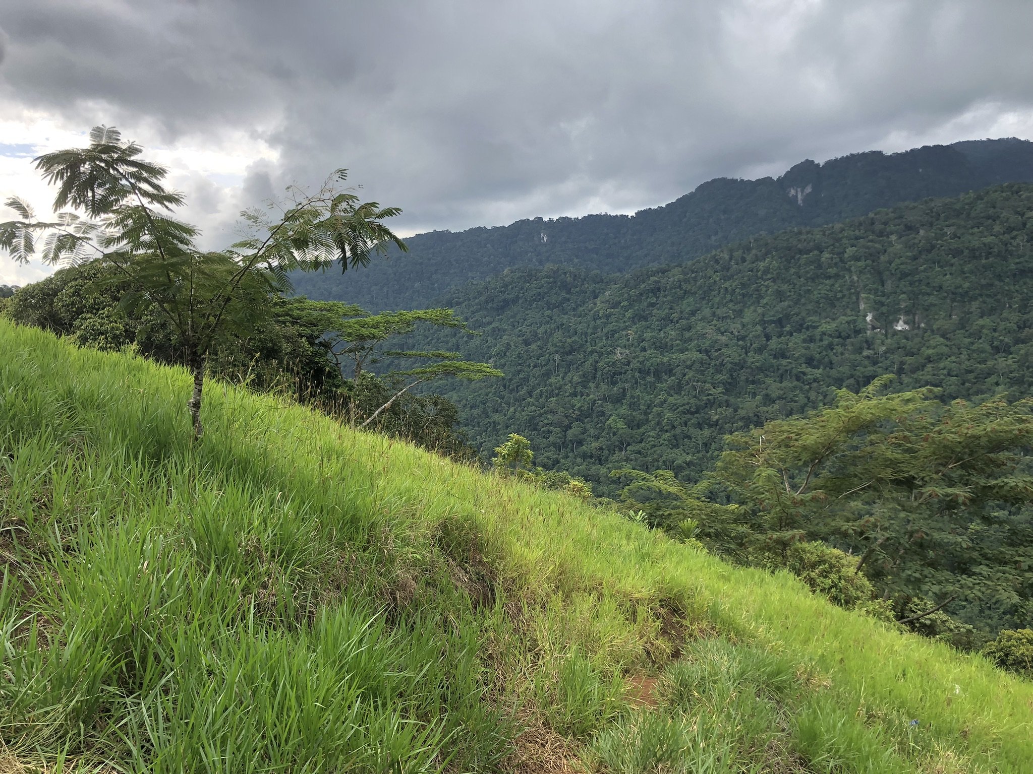
The Kokoda Trail crosses the Owen Stanley Ranges mountain range
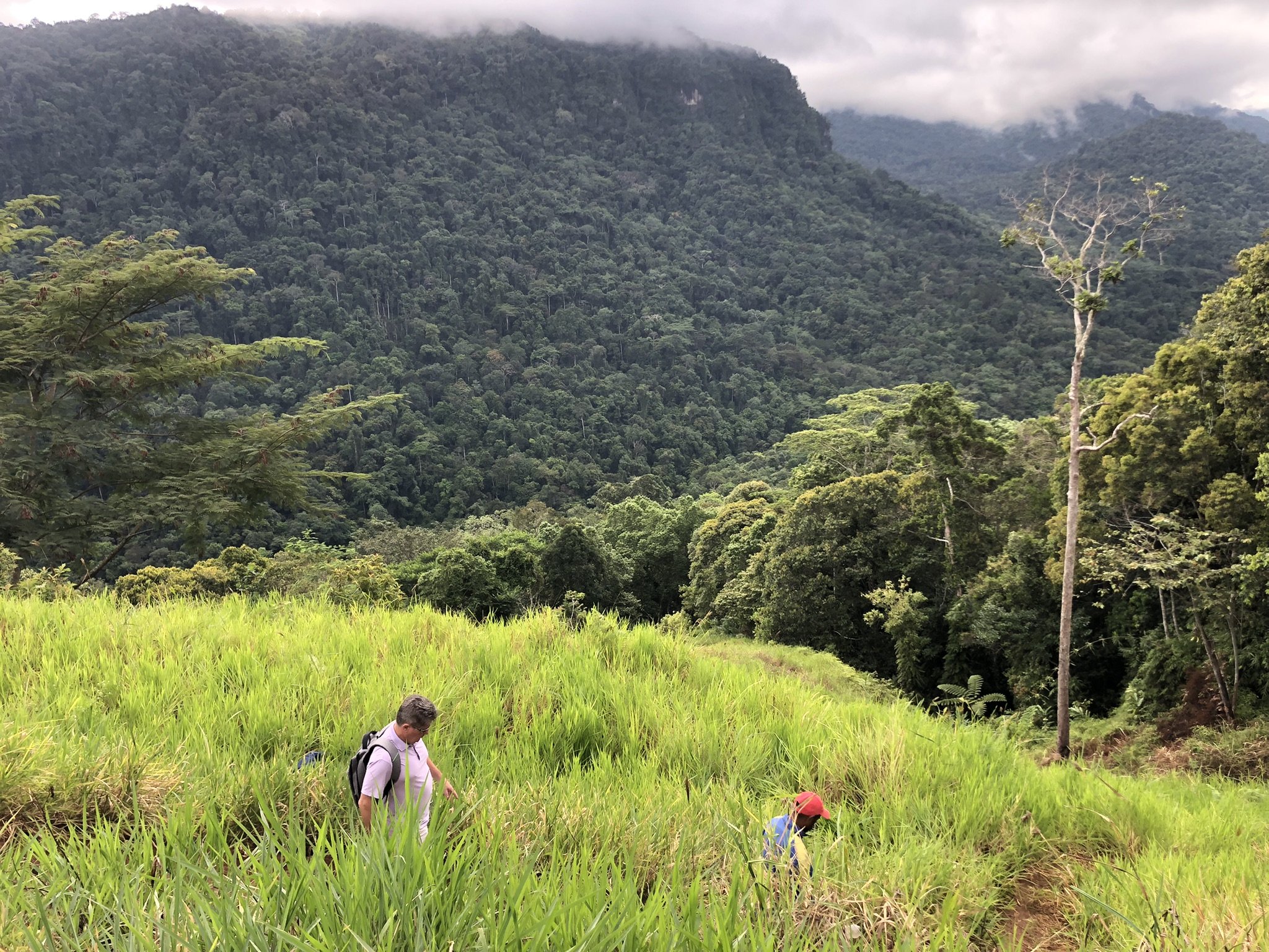
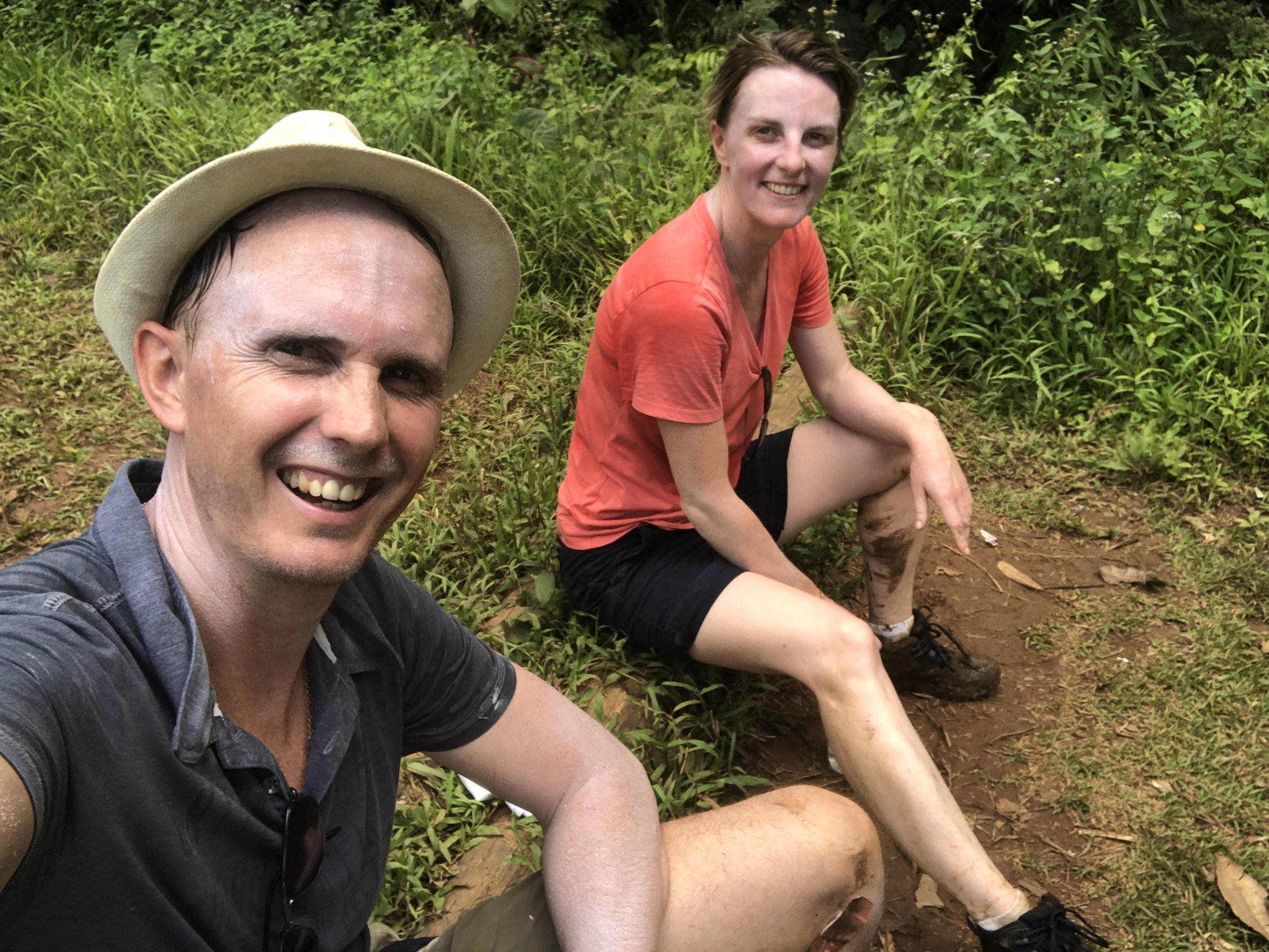
Today, we decided to hike the first leg of the trail — out and back. Sarah and Jean-Pierre are joining the adventure. From Port Moresby, it takes just over an hour by car to reach Owers Corner, the official start (or end) of the trail, and to discover its iconic arch marking the beginning of the journey. It seems we're the only hikers this morning.
However, we are warmly welcomed by two rangers, one of whom will accompany us. Our two drivers also want to join the walk. After passing through the arch, we cheerfully begin the steep descent that marks the start of the trek.


At this hour, we’re still feeling fresh. Jean-Pierre clings to his walking stick to avoid slipping, as the path is really muddy. Sarah is full of energy, and before long, I’ll be struggling to keep up with her.
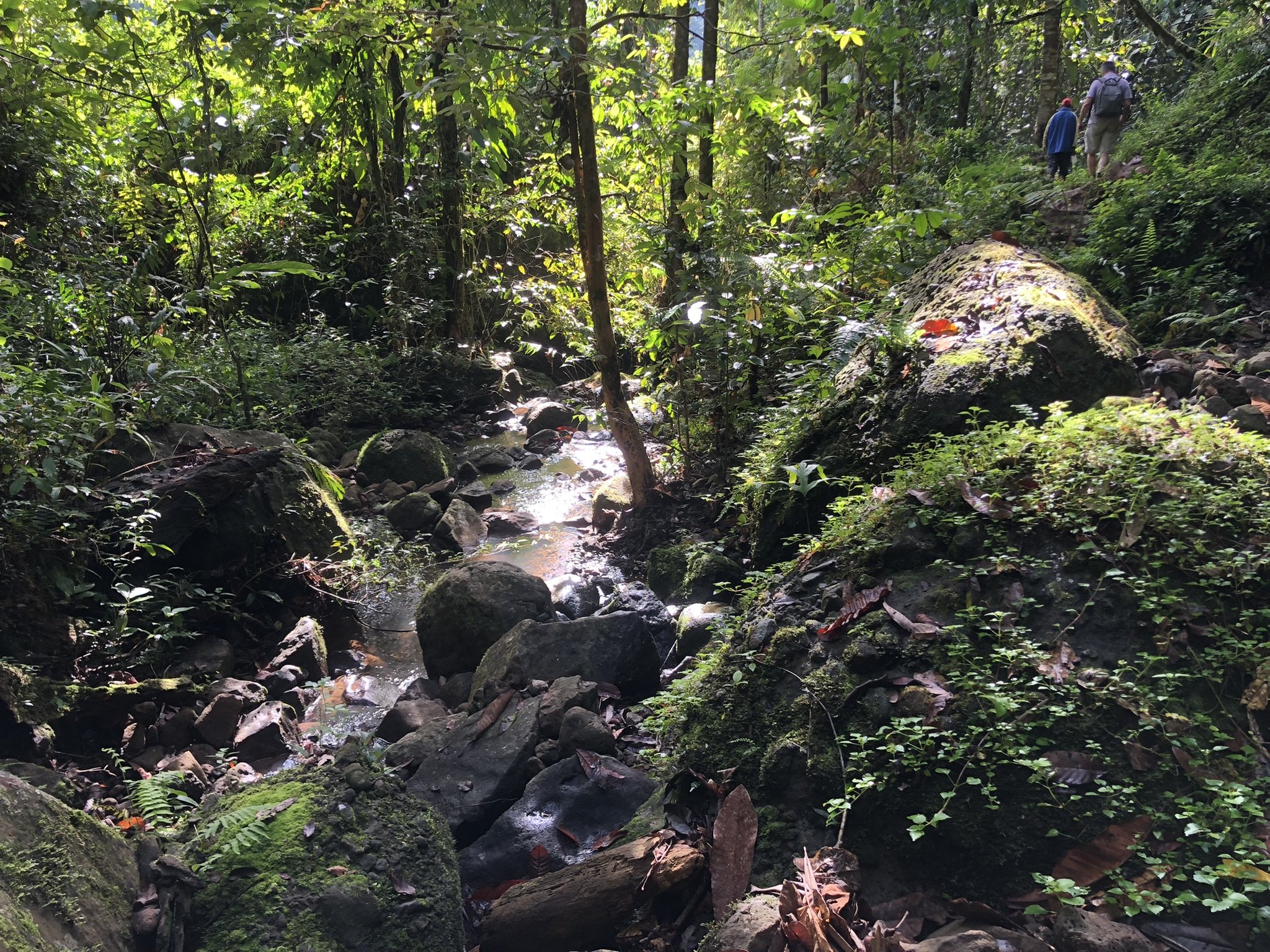
At last, we reach a beautiful river — the Goldie River — which we have to cross. The water comes up to our waists. Phew, we manage! We sit down to put our socks and shoes back on, under the amused gaze of our guide, who doesn’t seem bothered in the least, wearing nothing but simple flip-flaps.
But instead of the ranger, it’s one of our drivers who turns into our impromptu tour guide, telling us everything he knows about the local flora and fauna. He even takes the time to open a fruit for us — some kind of almond — that delights our taste buds.

Crossing the Goldie River
At last, we arrive at a first base camp — Camp 66. Funny enough, we don’t feel too tired. Sarah and I decide to keep going to reach the actual endpoint of the first stage: Imita Base Camp.
“Half an hour at most,” says the ranger. Well, at his pace — he’s practically galloping ahead of us. As Jean-Pierre points out, it’s not that he’s particularly fast, it’s that he’s steady. Not a single root, stone, or branch across the trail slows him down. He just keeps moving forward. Doesn’t even glance at his surroundings. Sure, he knows the place like the back of his hand — but let’s be honest: there’s not really a view to stop for anyway.
The forest we’re walking through is dense, giving us no chance to glimpse the kind of reward hikers usually hope for — a scenic vista. This climb is, above all, a physical challenge and a test of willpower.
It is at this moment that I think of the young Australian soldier who must have struggled too, carrying a military load on his back, with Japanese machine guns ready to mow him down, along with his comrades. Remembering this helps me accept the small sacrifice of this difficult climb.
Here we are, finally!
Imita Ridge, the final destination
The time has come to return. The descent is tough, and one of my toenails still remembers it. We’ll reach the river again, and this time, swimming is a must. How refreshing! Too bad the road doesn’t come this far. We’ll have to get dressed again, put on the completely damp socks and shoes, and continue the trail.
Another good hour before the archway marking the end of our one-day trek. Finally, it's in sight. But before we can touch it, one last effort – we need to climb the final meters. Nothing is designed for our comfort, and nothing will be spared.
It’s a slope, almost a wall, that we must climb. Yes, the descents from earlier are now the ascents at the end. We can't escape it. Just as I’m about to pass under the arch, my legs feel like jelly.

Return to Owers’ Corner and view of the arch marking the start of the trek
As if I had just returned from seven days of trekking, I collapse to the ground, flat on my back.
At that moment, I have no idea that in a few weeks, I will make the decision to complete the entire Kokoda Trail.